Blitz Detect
Blitz Detect Circles

Blitz Detect

The world's most advanced lightning detection system.

ABOUT BLITZ-DETECT

Blitz-Detect is a South African company that is powered by nowcast, a German company that operates high precision lightning detection systems all over the world. Blitz-Detect operates the South African lightning detection system using the nowcast LINET technology to ensure that we provide fast, efficient and reliable lightning detection systems using the most sophisticated measuring techniques which is critical in developing a smart efficient lightning detection system.

WHAT IS LINET SYSTEMS

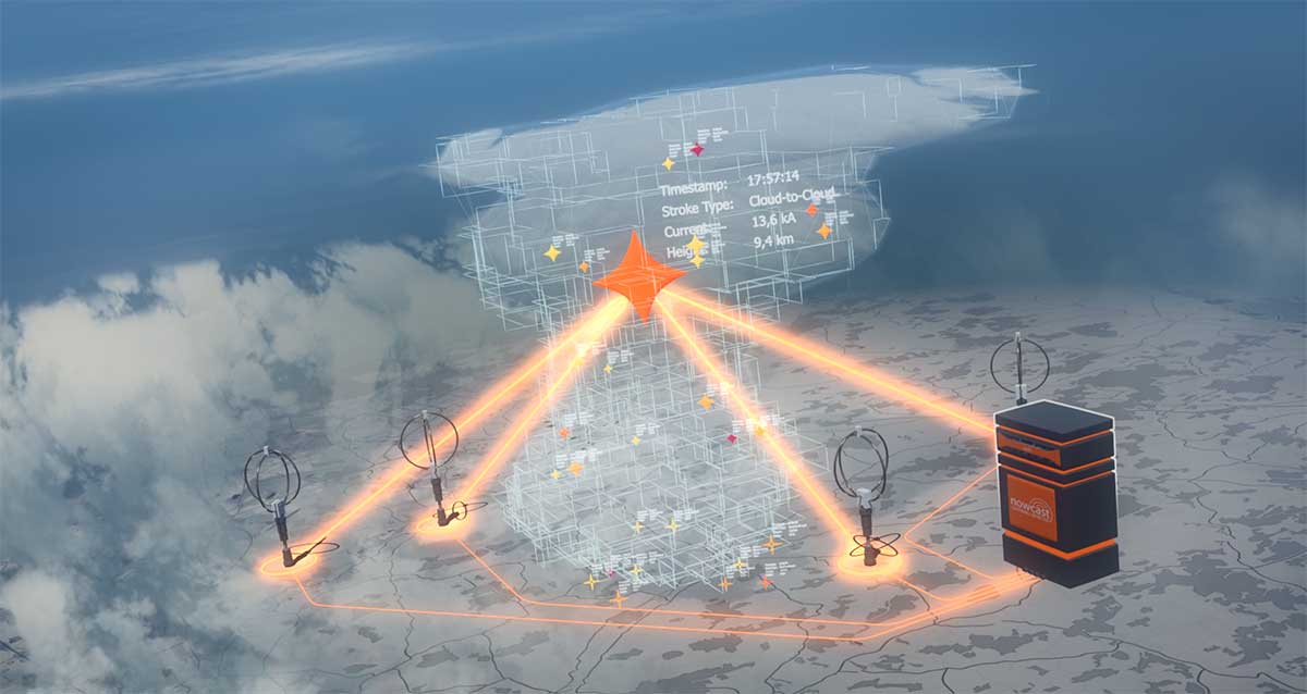
The nowcast system is the physical lightning detection network comprising of an already established array of sensors all connected to a central server. nowcast's lightning detection sensors record and digitalise the lectro-magnetic waves emitted by lightning strokes with the greatest degree of precision. Detailed knowledge of atmospheric physics has allowed LINET (Lightning Detection Network) systems to develop algorithms which set the highest standards of lightning detection, tracking and prediction.

WHAT IS LINET VIEW

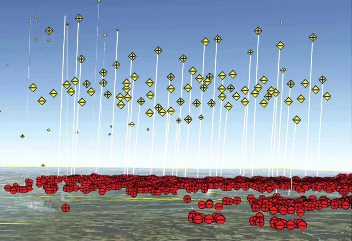
LINET view is our online user interface that our customers use for lghtning data visualization and early warnings which is setup to suite the individual requirements for each and every customer. LINET view offers various products designed to meet the different needs of our cutsomers, whether it be early warnings or historical lightning data. LINET view provides our customers with an intelligent, easy to use decision making platform that enables timeous evacuation planning and fewer false alarms.

Detect. Inform. Protect.

Lightning Detection and Thunderstorm Warnings

Watch Video

Highest possible precision, speed and reliability in lightning detection and lightning data - this is what Blitz-Detect stands for. Why should you settle for less when nowcast can meet your requirements at a sensible price?

Opt for the best-in-class 3D-real-time technology and take advantage of the highest possible quality ranging from real-time data to historical data:

Blitz-Detect powered by nowcast offers ultra-precise German engineering.

Industry Solutions

Weather Service Solutions

Weather Service Providers
Aviation
Insurers
Energy Suppliers
Wind Energy Sector
Scientific Institutions
Telecommunication
Outdoor Facilities

How lightning strokes are detected

The system essentially comprises two modules: several lightning sensors and a central server.

The lightning sensors consist of one magnetic field antenna, a GPD and a field processor.

Electromagnetic radiation emitted by lightning strokes is measured by ultra-sensitive lightning sensors. As the electromagnetic radiation spreads almost at the speed of light, it reaches the sensors at slightly varying times. Even though this difference is a matter of mere microseconds (μs), it enables precise calculation of the lightning stroke location. The data recorded by each lightning sensor is transmitted to a central processing server via the internet.

This server then calculates the exact geographical position for all the lightning strokes measured and stores them in a database.

The results are then made available to the customer in real time. This measurement method is also referred to as the Time-of-Arrival (TOA) method. Within the LINET lightning detection network, lightning strokes are located with a statistical accuracy of on average 75 meters (mean value, low scattering). The precise measurements result in accurate, true-to-nature representations of the actual storm situation and almost completely rule out misdetections.

nowcast 3D
How nowcast works

Precise measurements result in accurate, true-to-nature representations of the actual storm situation and almost completely rule out misdetections.

circles
Real time tracking
Real Time Tracking

The nowcast algorithm calculates the severity of a storm and if applicable issues severe weather warnings for lightning, hail, heavy rain and gales for particular areas within the thunder cell.

Real time tracking of thunderstorms

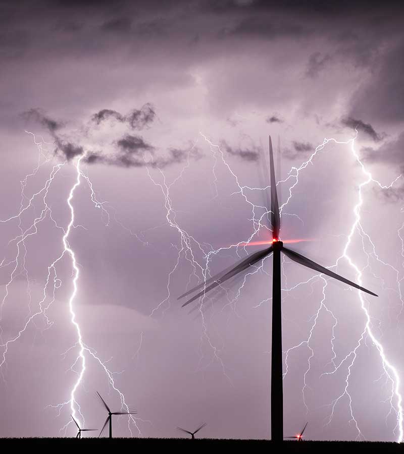
One to two hours before a strom cell arrives at a defined alarm region, the exact time of arrival, duration and passing of the thunderstorm can be calculated.

Thunderstorms normally occur in sharply delineated areas. This allows them to be easily grouped into storm cells.

nowcast's rTNT (real Time Tracking and Nowcasting of Thunderstorms) algorithm calculates storm cells in real-time. With every new lightning stroke, the cell is updated with respect to all its parameters.

With cell tracking, we can track and accurately predict where the lightning cells will move over the next 60 to 80 minutes. The resulting nowcasting then generates precise warnings in real-time for alarm regions defined in advance. This is invaluable information for the safe operation of all outdoor activities including sports events, golf courses and mining operations.

Accurate Early Warning

  • Minimization of risks arising from lightning hazards.
  • High accuracy lightning cell tracking and prediction.
  • Precise lightning & severe storm warnings in real time.
  • Early calculation of the arrival, duration and end of a thunderstorm in an alarm area.
  • Vastly reduced 'false alarms'.
  • Countdowns provide adequate warning for planning of outdoor operations.
  • Users are automatically informed via email, text message, an audible or visual alarm.

Patent 3D lightning detection

nowcast offers a patented method to easily identify intra-cloud lightning strokes even in the low-frequency range.

This cutting-edge technology enables nowcast to identify the precise height of intra-cloud lightning strokes.

Systematically recording the height of intra-cloud lightning strokes forms the basis for classifying the severity of storms.

For the first time, storm situations can be fully observed and analysed over the entire life cycle from the formation to the decline.

Detecting and determining the height of intra-cloud lightning strokes play a vital role in determining the severity of a storm.

Not only the ratio of intra-cloud to cloud-to-ground strokes provides information, but also the height of the thunder cloud: If the average height of a cell increases disproportionately, then a highly convective zone may be expected in which often not only lightning forms, but also hail and heavy rain.

This is a clear danger sign for weather services, aviation, motor industry and industrial facilities which can take in-time preventative measures.

A so-called 'lightning jump' indicates a severe weather situation. It is characterised by a sudden increase in both the altitude and number of lightning strikes within a small area over a very short time. nowcast's rTNT algorithm calculates the severity of the prevailing thunderstorm in real-time and issues timeous warnings to our clients.

Moderate storm
Moderate Storm

Modest IC Rate

Severe storm
Severe Storm

Strong IC Rate

Moderate Thunderstorm

Strokes / Altitude (km)

Severe Thunderstorm

Strokes / Altitude (km)